
RADAR FOR SUBSURFACE PROBING (GEORADAR)
|
|
|
|
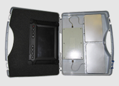
PURPOSE
Radar for subsurface probing (georadar) is used for geotechnical, geological, engineering and other purposes, where there is a necessity of a noninvasive electromagnetic environment monitoring
APPLICATION AREA
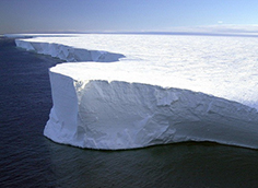
- Geology – to make records of geologic section, determine ground water levels or ice thickness
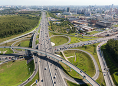
- Industrial and civil engineering – to analyse the quality and conditions of road surfaces, concrete and brick constructions, as well as to localize utility networks
- Safety – to determine mines, underground communication systems, storages, equipment, etc.
TECHNICAL CHARACTERISTICS
| Ice probing depth, m | 150 |
| Subsoil probing depth, m | 5...15 |
| Resolving power, m | 0,1...0,5 |
DEVELOPER
CONTACTS
☏ +375 17 293 84 42, +375 17 293 88 76
🖷 +375 17 293 84 96
🖂 info@mwmlab.com
🌐 mwmlab.com
✎ 6, P. Brovki str., Minsk, 220013, Republic of Belarus
OTHER INNOVATIONS IN THIS AREA
BASIC DEVICES, COMPONENTS AND MODULES FOR MICROWAVE AND EHF RANGES