
EMSE - a technique for assessing the electromagnetic safety of the population and the electromagnetic ecology of the environment in conditions of mass use of cellular communications and wireless information services
|
|
|
|
PURPOSE
EMSE (Electromagnetic Safety & Ecology) - a technique for assessing the electromagnetic (EM) ecology of the habitat and EM safety of population in conditions of mass use of cellular (mobile) communications and different wireless services. It is designed to analyze and estimate the electromagnetic background (EMB) intensity in conditions of mass coverage of the population with modern radio telecommunications - 2G/3G/4G/5G/6G... cellular communications and data transmission, wireless broadband access, etc.
APPLICATION AREA
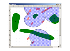
- Calculation of sanitary protection zones and zones of restriction of development of stationary radio objects with radio emission.
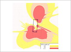
- Assessment of the risk to public health from exposure to electromagnetic fields generated by mobile communication systems and broadband wireless access, including this assessment at socially significant facilities.
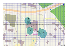
- Evaluation of the EMB intensity created by base stations and users' equipment for mobile communications and wireless access, as well as stationary radio transmitters of various services (radio communications, television and radio broadcasting, radar, etc.) in areas with high population density.
PECULIARITIES
- The technique takes into account the forced environmental risks caused by the action of electromagnetic radiation from mobile user's equipment (cell phones, PC radio modems, mobile Internet user's equipment, mMTC / IoT peripheral equipment, etc.).
- Both energy and probabilistic criteria for the electromagnetic safety of the population are used, which objectively reflect the features of the statistical characteristics of the ensemble of electromagnetic fields of a multitude of mobile and stationary sources of electromagnetic radiation.
- Evaluation of the EMB intensity created near the earth's surface by many electromagnetic fields of mobile communication systems and broadband wireless access is performed on the basis of the forecast of the integrated system characteristics of radio networks and wireless services - the average electromagnetic load on area, the average area traffic capacity, the average spatial density of user's and peripheral radio equipment, etc.
ADVANTAGES
- The technique provides an opportunity for an objective assessment of the contribution of electromagnetic radiation from mobile user's devices to electromagnetic pollution of the habitat.
- Evaluation of the EMB intensity created near the earth's surface by a multitude of electromagnetic fields of mobile communication systems and broadband wireless access, based on the prediction of the integral system characteristics of radio networks and wireless services, is the only possible one from a practical point of view, since it does not require the calculation of a plurality of radio links between an observation point and sources of electromagnetic radiation, the number and location of which, as a rule, are unknown.
DEVELOPER
R&D Lab 1.7 "Electromagnetic compatibility of radio equipment"
CONTACTS
6, P. Brovki str., 220013, Minsk, Republic of Belarus
☏ +375 17 293 84 38
🖷 +375 17 293 89 94
🖂 emc@bsuir.by
🌐 emc.bsuir.by
OTHER INNOVATIONS IN THIS AREA
ADFTT / ADFTS – automated double-frequency test technique and system